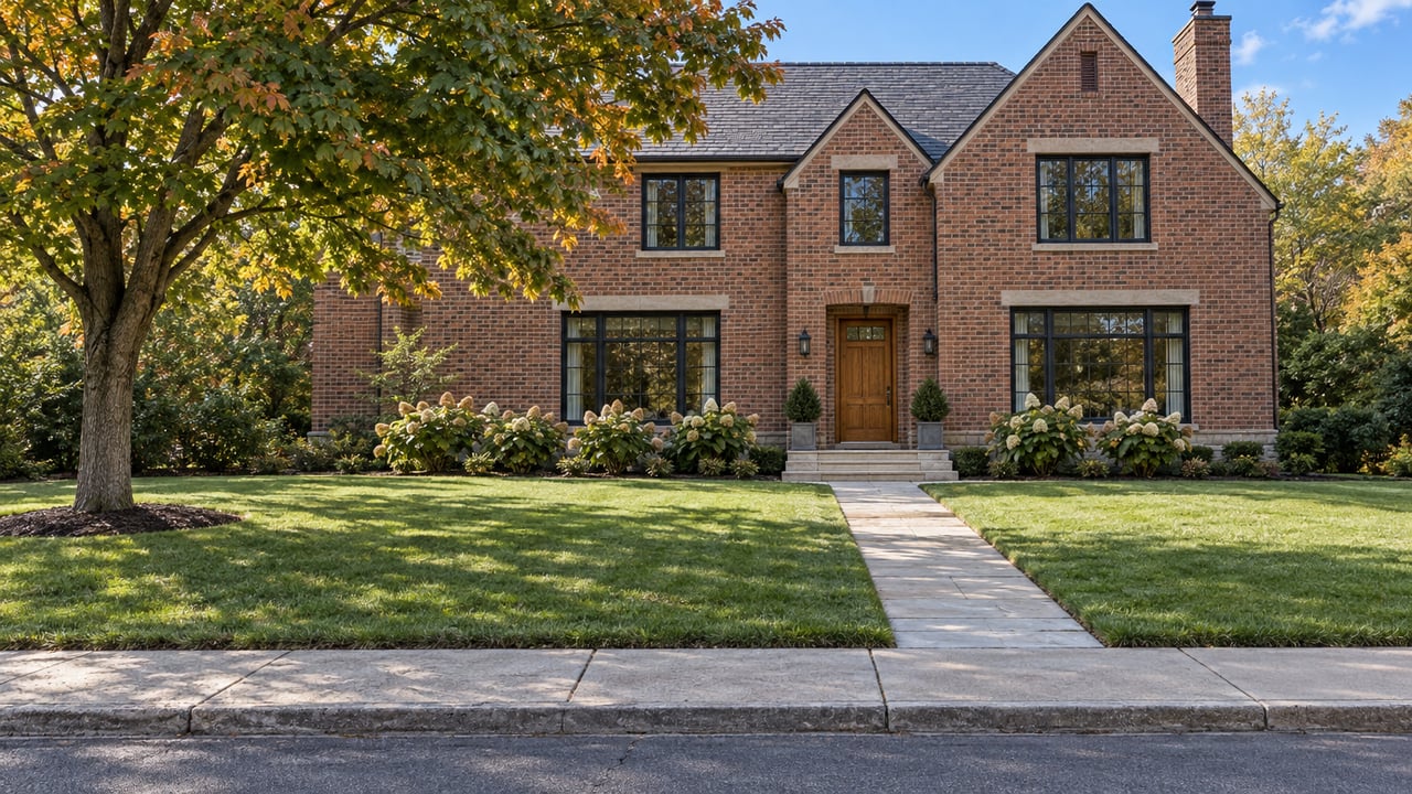
When you stand on the lawn of a house on Dawlish Avenue or Mildenhall Road, how much of the grass belongs to the house? On many Lawrence Park streets, the honest answer is less than it looks. According to the City of Toronto, its right-of-way extends about 10 metres from the centre of the road to the private property line. The City has already approved a plan to rebuild many of these roads, and that rebuild happens on the City's side of the line.
For buyers, that matters more than the asking price. Everything in the strip between the curb and the property line is up for review once the City's engineers reach detailed design. That includes landscaping, fencing, irrigation, interlock and heated driveways. The City says it will work closely with homeowners on their concerns. It does not promise that any particular feature stays.
The arithmetic behind a Lawrence Park frontage
Rebuilt streets in this program are designed to a standard 7.2-metre pavement width with curb-and-gutter drainage. Half of that is 3.6 metres from the centreline to the curb. If the right-of-way runs about 10 metres from the centreline, a rough subtraction leaves around six metres of City land on each side, beyond the pavement edge, before private property begins. The real figure will vary by street and lot, and only a survey settles it for a specific house.
On a typical tour, that six-metre band holds the parts of a home that make a strong first impression:
- the stone walkway and interlock apron at the end of the driveway
- the heated driveway section near the street
- low decorative fencing and garden beds
- irrigation heads along the lawn edge
All of these features fall within the City's list of items to be reviewed during design. None of this hides anything about a particular property. These details simply aren't in a listing and don't show up in a comparable sale.
What the City plans to build in that strip
The work comes out of the Lawrence Park Neighbourhood Road & Stormwater Management Study, an Environmental Assessment finalized on January 31, 2018. The package covers road reconstruction and resurfacing, storm and sanitary sewer upgrades, drainage work and new sidewalks. The City will deliver it through its Basement Flooding Protection Program.
Reconstruction goes deeper than repaving. The City's engineering FAQ says roads needing reconstruction require excavation to replace the road base, about 0.6 metres down. It also says localized narrowing or shifting of the road will be considered to avoid removing mature trees. To protect trees during the work, the City lists hand digging, air spades and root-protection measures.
Sidewalks will change frontages the most. Council approved new sidewalks on one side of five streets:
- Mildenhall Road, east side
- St. Leonards Avenue
- Dawlish Avenue
- Pinedale Road
- Glenallen Road and Strathgowan Crescent
Except for Mildenhall, the approved plan doesn't say which side of the street gets the sidewalk. On these five streets, two houses facing each other could end up with quite different frontages after construction.
Parking changes too. The FAQ says parking on Mildenhall Road will largely stay as it is, and parking around Cheltenham Park will be examined with residents during detailed design. On the other streets, parking will be limited to one side, and it will not be allowed where the road narrows below 7.2 metres to protect trees. Narrowing and chicanes are part of the approved changes, so on-street parking may not stay where it is today.
A schedule that keeps moving later
The timeline matters most for someone buying now, and it has moved several times.
| Date | What the City said or did |
|---|---|
| May 2015 | Public information centres on the Environmental Assessment, including sidewalks and trees, summarized in an August 2015 report |
| May 2016 | FAQ says construction could begin as early as 2020, phased over about 10 years, at an estimated $75 million |
| January 31, 2018 | Environmental Assessment final report |
| June 4, 2025 | North York Community Council considers and adopts the Lawrence Park Transportation Plan |
| March 25, 2026 | Notice of site work: two phases, with Phase 1 preliminary design underway |
| April 15 to July 31, 2026 | Expected window for detailed-design field investigations |
| Fall 2027 | Earliest expected start of Phase 1 construction |
| 2027 to 2032 | Implementation window for road narrowing and chicanes |
The 2016 estimate expected construction to be about two-thirds done by now. Instead, the March 2026 notice says Phase 1 construction "is not anticipated to begin until Fall 2027." It also says field investigations were still needed before detailed design could start. Those investigations included boreholes in the road and sidewalk, test pits dug with heavy machinery, land surveying in roadways and boulevards, and assessment of nearby trees. As of October 2026, we have not found a public confirmation that the field work finished or that detailed design has started.
Every year the schedule slips, the disruption lands on a different owner. A seller who has lived on Dawlish for twenty years may never see a construction fence. A buyer who closes this fall is likely to be the household that deals with it, on a timeline nobody can confirm today.
The argument behind the sidewalks
These sidewalks were debated for a long time before they were approved. At the 2015 consultations, some participants supported one sidewalk on Mildenhall for safety while limiting tree impacts. Others wanted two sidewalks for connectivity and for walking safely after dark and in winter. Some opposed a sidewalk on St. Leonards Avenue, citing tree impacts and what they saw as low foot traffic. The City's own summary records competing priorities. On one side were the mature trees and the area's rural character. On the other was replacing open ditches with curbs and sidewalks for safety.
In 2018, the Lawrence Park Ratepayers' Association ran a road-safety survey. Respondents flagged the missing sidewalk on Mildenhall as a leading problem, and 38 of the 50 solutions proposed for it were sidewalk suggestions. The association notes the survey was not scientific.
The approved sidewalks are no longer open for debate. When the City consulted on its Transportation Plan in 2024, comments on the already-approved sidewalks were explicitly outside the scope. The open questions are about design: where the sidewalk sits, how the road shifts around trees, and what happens to the features already in the right-of-way.
Speed humps arrive on a separate track
The Transportation Plan added a second, faster layer. North York Community Council authorized 45 speed humps on streets that are not being reconstructed, or where there is community support. The list includes 21 on St. Leonard's Avenue between Weybourne Crescent and Bayview Avenue, eight on Dawlish Avenue, and four each on Cheltenham Avenue and Dinnick Crescent. The City targeted installation for 2025 to 2026. We have not found public confirmation that they are in, so treat them as authorized until you see them on the street.
What to settle before you make an offer
- Confirm the street's status. Check whether the house is on one of the five sidewalk streets, on a reconstruction street, or on a speed-hump street. The March 2026 notice includes a map of the Phase One work area, but its text doesn't list streets by phase. Ask the City which phase covers the address.
- Find the actual property line. A survey or title search shows where private land ends. Compare it with the interlock, fencing and garden beds you are paying for.
- List what sits in the right-of-way. Heated driveway sections, irrigation and decorative fencing are the features the City says it will review.
- Check how much you rely on street parking. Apart from Mildenhall and the parking around Cheltenham Park, which is still to be reviewed, the City's FAQ says parking will be limited to one side.
- Sign up for City notices. The City says design details and chances for public feedback will come through future notices and public events.
This is practical due diligence, not legal advice. A real estate lawyer can tell you what your survey and title documents mean for a specific property.
A few questions buyers ask us
Will the City remove landscaping in the boulevard?
The City has said features in its right-of-way will be reviewed during detailed design and that it will work with homeowners. No detailed design for any street has been published yet, so no outcome is decided.
Does a sidewalk street lose its trees?
The City's stated approach is to shift or narrow the road in places and use hand digging and root protection to limit tree loss. Site-specific tree impacts will be known once detailed design is done.
Who pays for the road work?
In 2016, the City estimated the improvements at $75 million, funded through its capital budget for state-of-good-repair work. That figure is a decade old, and we have not found a newer public estimate.
If you are buying or selling on Mildenhall, St. Leonards, Dawlish, Pinedale or Glenallen, Jamie Dempster and the team can help you check the survey, flag what sits in the City's right-of-way and factor the road rebuild into your price. Request a Free Home Evaluation and we'll walk the frontage with you.